

This blog breaks down how Indrajaal’s autonomous aerial security system actually works, and what sets it apart. It covers the four core capabilities every capable C-UAS needs, how a geospatial command-and-control (C2) system turns raw sensor data into an actionable response, and the three pillars behind Indrajaal’s differentiation: a single autonomous architecture, decentralized mesh deployment, and predictive, coordinated response
Indrajaal is an autonomous, AI-powered counter-unmanned aerial system (C-UAS) built to detect, track, identify, and neutralize drone threats of all classifications through 12 integrated technology modules, including the patented HyperSensing™ and WeaponFusion™ systems, coordinated by a single geospatial command-and-control core rather than a stack of separate point products.
Key takeaways
- Effective Counter-UAS technology needs four core capabilities: detection, tracking, identification, and mitigation — most systems on the market deliver only some of these, requiring multiple vendors stitched together.
- A geospatial command and control (C2) system — fusing RF sensors, radar, and video into one analytical layer — is what turns raw sensor data into an actionable threat assessment and response recommendation.
- Indrajaal®, launched in 2020 after 15 years of R&D and built on a team with three decades of radar and airspace-management expertise, is positioned as a single autonomous system spanning all drone classifications, rather than a stitched-together stack of point products.
- Indrajaal’s differentiation rests on three pillars: a single autonomous architecture (12 integrated technology modules including patented HyperSensing™ and WeaponFusion™), decentralized mesh-based deployment, and intelligent response — trajectory prediction and countermeasure orchestration, not just detection.
Table of Contents
- Understanding the Challenge of Unmanned Aerial Systems (UAS)
- The Role of Autonomous Counter-UAS in Modern Security
- What Should Counter-UAS Capabilities Include?
- Inside a Geospatial Command and Control (C2) System
- Key Features of the Geospatial C2 System
- Indrajaal® — A 360° Counter-UAS and Drone Defense System
- What Makes Indrajaal Different
- How Indrajaal Was Built: Solving a Genuinely Three-Dimensional Problem
- Frequently Asked Questions
- Conclusion
Understanding the Challenge of Unmanned Aerial Systems (UAS)
Unmanned aerial systems (UAS) present real and growing risk in an increasingly drone-saturated world. Devices originally built for surveillance, delivery, or recreational use now carry the capability to invade privacy, compromise physical security, and disrupt critical infrastructure.
The technology behind UAS keeps advancing – longer range, heavier payloads, more autonomous flight, which is exactly what raises the stakes around potential misuse by individuals or groups with malicious intent. Addressing this class of threat requires more than a single sensor or countermeasure; it requires a genuinely multi-faceted technical approach.
For a broader look at why this matters across industries, see: Counter Drone Systems: Comprehensive Guide [2026]
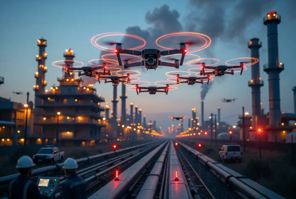
The Role of Autonomous Counter-UAS in Modern Security
In the current landscape of evolving threats posed by Unmanned Aerial Systems (UAS), there is a pressing need for the development and implementation of autonomous Counter-Unmanned Aerial Systems (C-UAS).
These autonomous systems play a vital role in safeguarding critical infrastructure, public events, and military operations from potential security breaches or attacks initiated by rogue drones. By utilizing cutting-edge technology such as AI and sensors, autonomous C-UAS can effectively detect, track, and neutralize unauthorized drones swiftly and with precision.
This proactive approach ensures a rapid response to potential threats, helping to mitigate risks and enhance overall security measures. As the UAS technology continues to advance, the importance of autonomous C-UAS becomes increasingly evident in maintaining a safe and secure environment for various applications.
What Should Counter-UAS Capabilities Include?
A genuinely capable C-UAS platform needs to deliver on four fronts:
Detection
Detecting and monitoring drones is the foundation of any C-UAS deployment. Systems are designed to alert operators the moment a drone enters a designated warning zone, whether from a fixed installation or a portable unit. Detection typically draws on radar, optical sensors, and acoustic sensors working together to reliably identify incoming drones.
Tracking
Once a drone is detected, a counter-UAS solution may possess the ability to track the drone’s flight path and pinpoint the location of the pilot. This provides valuable airspace situational awareness to the operator, enabling timely and appropriate responses to the drone presence.
Identification
With the surge in drone usage across various industries, it is essential to accurately identify drones operating within a specific area. Upon detection, the operator can classify the drone as either friendly or hostile, allowing authorized drones to continue their operations uninterrupted by the counter-UAS system.
The system is able to detect the model of the drone, providing security personnel with valuable information on the drone’s range, speed, and payload capabilities within their airspace.
Mitigation
To combat unauthorized drones, mitigation technologies can be utilized. Interference signals can disrupt the drone’s operations, while active countermeasures such as jamming devices, missile interception systems, and high-power lasers can deter or disable drones and their operators.
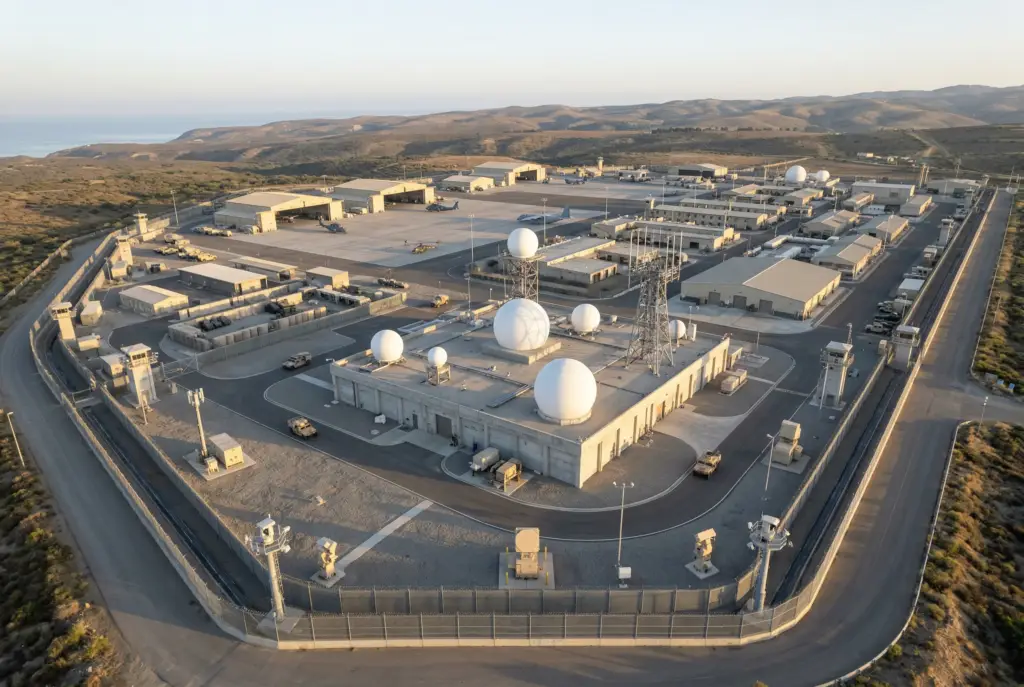
Inside a Geospatial Command and Control (C2) System
Anticipating and responding to drone threats effectively depends on a geospatial C2 system — the analytical layer that fuses multiple data sources into one coherent airspace picture. The core data sources are RF sensors, radar sensors, and video feeds.
RF sensors scan the electromagnetic spectrum to identify and categorize drone signals, pinpointing drones by their unique radio-frequency signatures and analyzing communication patterns. This offers early insight into a drone’s presence, behavior, and likely intent well before visual confirmation is possible.
Radar sensors provide comprehensive airspace surveillance by emitting radio waves and analyzing the reflected echoes from objects, including drones. Modern radar can distinguish a suspected drone from a bird or other object, and accurately determine position, velocity, and altitude — enabling real-time monitoring and situational awareness.
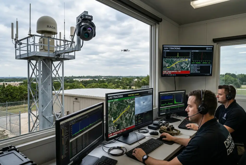
Key Features of the Geospatial C2 System
Detection and Identification
The C2 system utilizes a combination of data sources to detect and identify drones. By analyzing RF signatures, radar returns, and video feeds, the system can differentiate drones from other objects in the airspace based on their presence and characteristics.
Tracking and Monitoring
Upon detecting and identifying drones, the C2 system employs tracking algorithms to monitor their movements accurately. This capability allows operators to maintain real-time situational awareness, track drone positions, and anticipate their trajectories.
Threat Evaluation and Categorization
The C2 system employs sophisticated algorithms and analytics to evaluate the characteristics and seriousness of potential drone threats. By examining data from various sources such as RF signals, radar readings, and video recordings, the system can categorize drones based on their actions and intentions, assigning a corresponding risk level.
Decision-Making Support and Response
Drawing upon the threat assessment, the C2 system equips operators with decision-making tools to assist them in determining the most appropriate response tactics. This includes issuing alerts, presenting visualizations, and suggesting countermeasures to effectively mitigate the identified threats.
Integration of Countermeasures
The geospatial C2 system streamlines the incorporation and synchronization of countermeasures to neutralize drone threats. Organizations should employ counter-UAS technologies, implement response procedures, and collaborate with relevant security forces for a prompt and efficient reaction.
Indrajaal® — A 360° Counter-UAS and Drone Defense System
Indrajaal® was created in 2020 after 15 years of extensive research and development in autonomous aerial security systems. The team behind Indrajaal possesses a wealth of expertise in radar technology and airspace management spanning three decades.
Indrajaal stands as the world’s sole counter unmanned aerial system (C-UAS) capable of autonomously safeguarding against drones of all classifications. The system integrates 12 modules of cutting-edge technology, including the patented HyperSensing™ and WeaponFusion™ technologies. This seamless integration delivers a unified and supremely efficient autonomous drone security system.
Unlike traditional systems that rely on one type of sensor, Indrajaal consolidates data from multiple sources such as radar, cameras, and other sensors. Powered by advanced AI algorithms, this technology analyzes real-time data to accurately differentiate between authorized and unauthorized aerial systems.

What Makes Indrajaal Different
Most counter-drone systems on the market today are stand-alone, piecemeal, or require constant human operation to function. Indrajaal is built as a single autonomous system, with multi-spectral illumination and autonomous operation coordinated through one central command and control center.
Three things define that difference in practice:
- A true 360-degree architecture. Decentralized, mobile, AI-enabled deployment is achieved through a wide array of sensors and technologies connected to the Command & Control Centre via a fully secured mesh network. Modular deployment, well-defined connectivity, and AI-driven process flows sit at the center of the design.
- Intelligent response, not just detection. Using real-time tracking and trajectory prediction, Indrajaal gives security personnel precise data on both a drone’s current location and its likely future path — not just where it is now. That predictive layer is what enables coordinated deployment of jamming, spoofing, and interceptor countermeasures as one orchestrated response, rather than a set of separately triggered tools.
- Purpose-built adaptability. Every deployment differs, drone dimensions, operational terrain, and local regulation all vary site to site, which is why the system needed to be comprehensive without becoming rigid.
How Indrajaal Was Built: Solving a Genuinely Three-Dimensional Problem
Indrajaal was developed with the primary objective of addressing a multifaceted three-dimensional problem. This encompassed the determination of the rogue drone’s dimensions, assessment of the operational terrain, and consideration of local regulations. These factors vary significantly for each installation, thereby necessitating a solution that is both adaptable and cost-efficient. The solution had to be comprehensive yet customizable to meet diverse needs. As a result, overcoming this obstacle demanded meticulous design, planning, and innovative problem-solving strategies
To address these challenges, we adopted a LEGO block approach for technology design. This approach allowed us to modularize our solution, enabling it to accommodate various combinations of individual components in real time. By structuring our solution in this manner, we ensured that Indrajaal could adapt seamlessly to different environments and regulatory frameworks while remaining effective and efficient. This innovative design strategy played a crucial role in addressing the complexity of the problem and ensuring the success of Indrajaal in real-world deployments.
Frequently Asked Questions
What is Indrajaal?
Indrajaal® is an autonomous, AI-powered counter-UAS (C-UAS) platform built to detect, track, identify, and neutralize drone threats of all classifications through 12 integrated technology modules, including patented HyperSensing™ and WeaponFusion™ systems.
What are HyperSensing™ and WeaponFusion™?
HyperSensing™ and WeaponFusion™ are Indrajaal’s patented technologies for multi-sensor data fusion and coordinated countermeasure deployment, forming part of the platform’s 12 integrated technology modules.
What makes Indrajaal different from other C-UAS systems?
Most counter-drone systems are stand-alone or require manual operation. Indrajaal is built as a single autonomous system with a centralized command and control center, decentralized mesh-based sensor deployment, and intelligent trajectory-predictive response — rather than a stack of separately operated point products.
What are the four core capabilities a Counter-UAS system needs?
Detection, tracking, identification, and mitigation. Detection alerts operators to a drone’s presence; tracking follows its flight path; identification classifies it as friendly or hostile; and mitigation — jamming, spoofing, or interception — neutralizes confirmed threats.
What is a geospatial command and control (C2) system in counter-drone defense?
A geospatial C2 system fuses data from RF sensors, radar, and video feeds into a single operational picture, enabling threat evaluation, categorization, and coordinated countermeasure response, rather than treating each data source in isolation.
When was Indrajaal founded, and what’s the team’s background?
Indrajaal® launched in 2020, following 15 years of R&D in autonomous aerial security, built by a team with three decades of combined expertise in radar technology and airspace management.
Conclusion
The gap between a genuinely autonomous C-UAS platform and a collection of point products, a jammer here, a radar there, a human operator tying it all together – is the gap that decides whether a system holds up against a real, fast-moving threat. Indrajaal’s architecture – a single autonomous system, decentralized mesh deployment, and predictive, coordinated response – was built specifically to close that gap, informed by a modular design philosophy shaped by real deployment constraints rather than lab conditions alone.